
Alex McPhee
Pronghorn Maps


Howdy!
I'm an independent cartographer based in Val Marie, Saskatchewan. It's as fun as it sounds! I publish maps, accept contracts, and do custom work in print and online. If you want to hire me, find everything you need here.
I specialize in producing really excellent wall maps, and this website is the only place to buy them online. If you're here to place an order, then skip straight ahead to my online checkout. For more information and high-resolution preview images, keep reading!
Reference Maps
The gold standard of wall maps. Internationally recognized, Canadian printed, competitively priced. Start your tradition of cartographic excellence today:


Alex McPhee's Alberta
The best in its class.
Starting at $59.99
- Highly Commended (BCS, Stanfords Award, 2021)
- Best Reference Map (Cartography and GISociety, 2020)
- Best in Design (Student) (NACIS, 2019)


Alex McPhee's Saskatchewan
Second edition available!
Starting at $59.99
- Every grain elevator
- Every grid road
- Hutterite colonies
- Treaty boundaries
- Reserve surrenders
What's next? Saskatchewan becoming a best-seller has diverted a lot of my creative time into sales, but I'm not complaining. Expect Manitoba and Canada (with an emphasis on modern treaties) in, perhaps, 2025.
Election Maps
By popular demand. Politics is confusing enough, get the election maps that show you what's really going on. Perfect for armchair academics and public advocates.


American State Legislatures
Fill out the pre-order form
Prepare to understand the legislative branch of government like you never have before.


House of Commons Cartograms
Available soon
Land doesn't vote, and Canada has so very much of it. Federal elections from 1968 to 2021.
Map Portfolio
Produced on my own time for my own purposes. Click to open in a new tab.
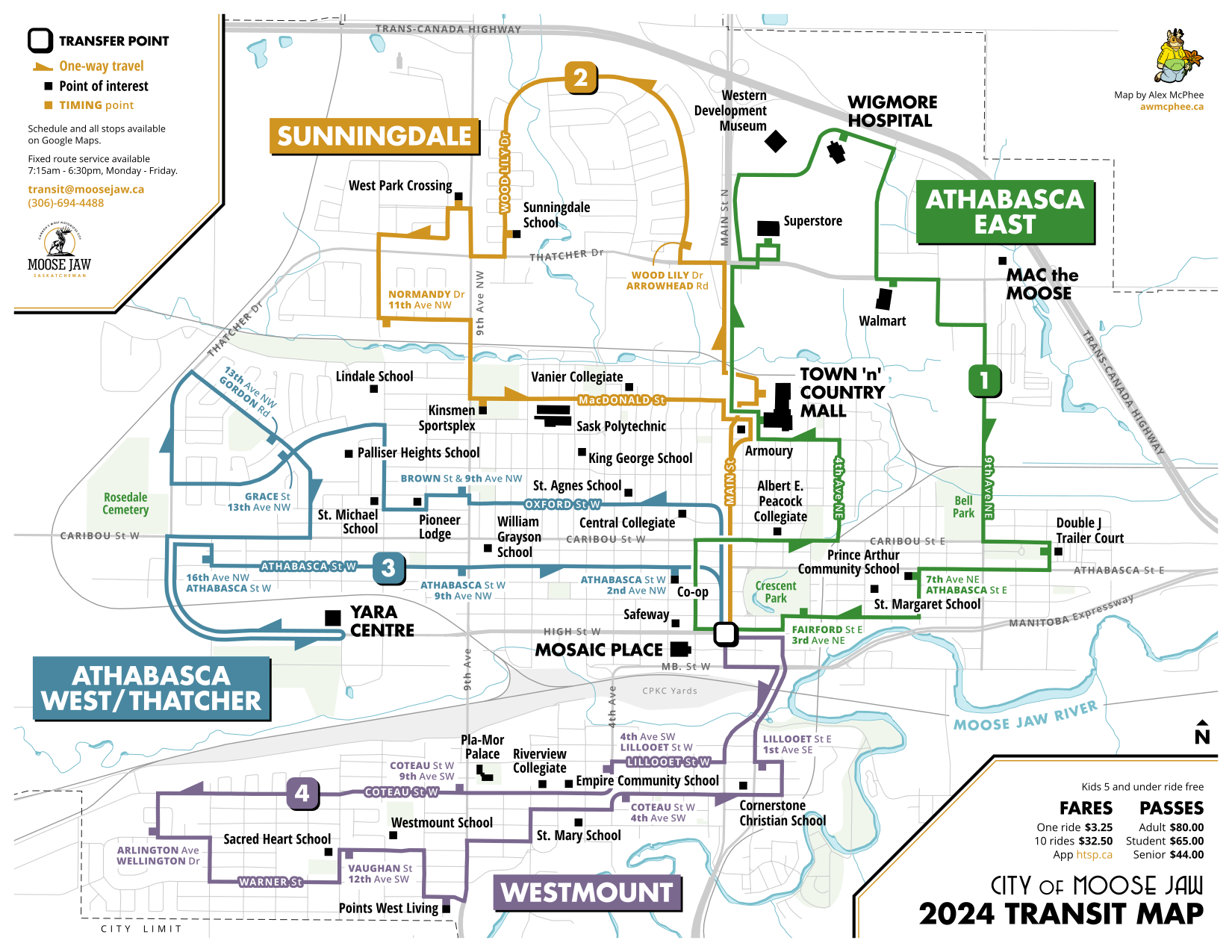
City of Moose Jaw Transit Map
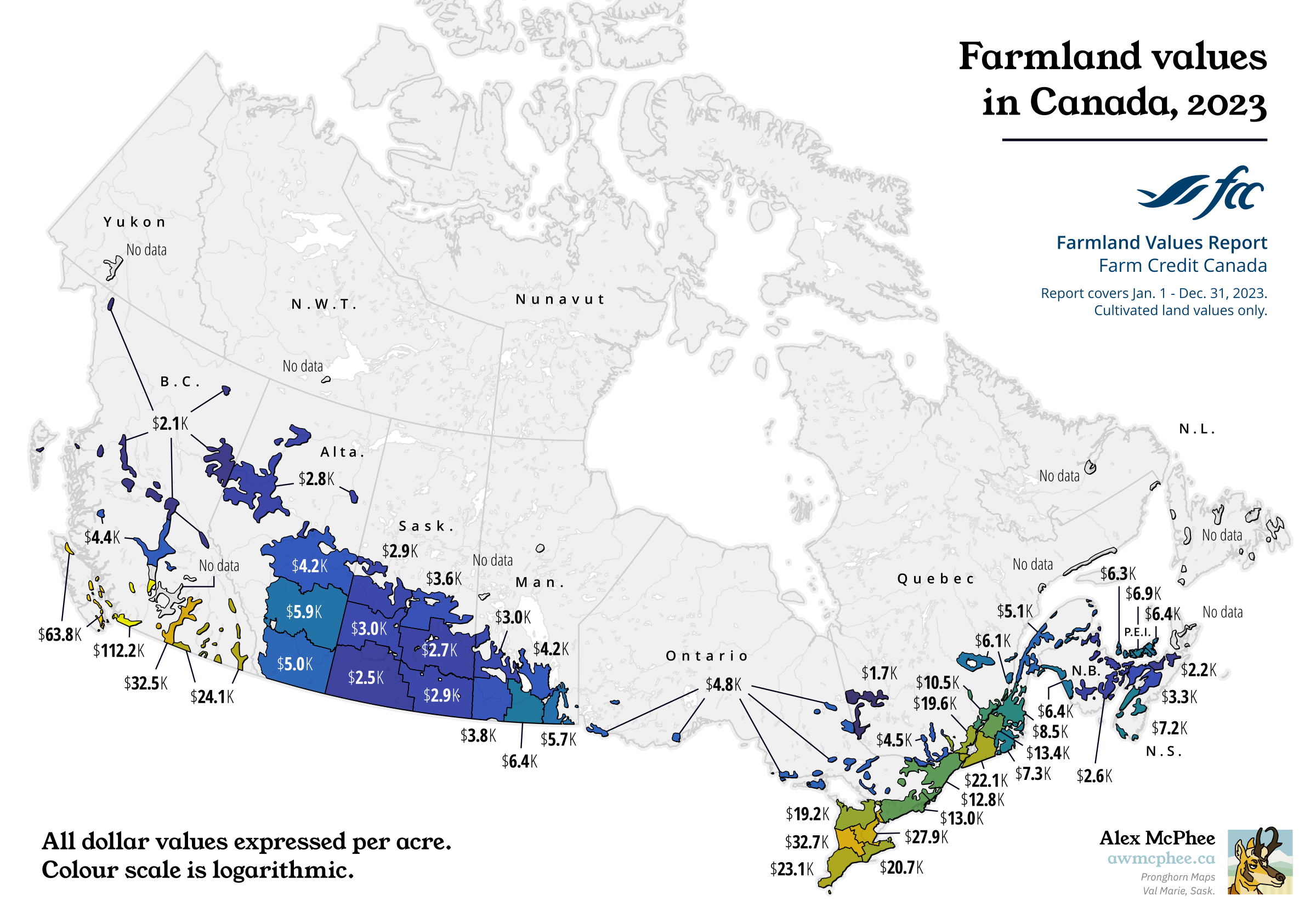
Farmland values in Canada, 2023
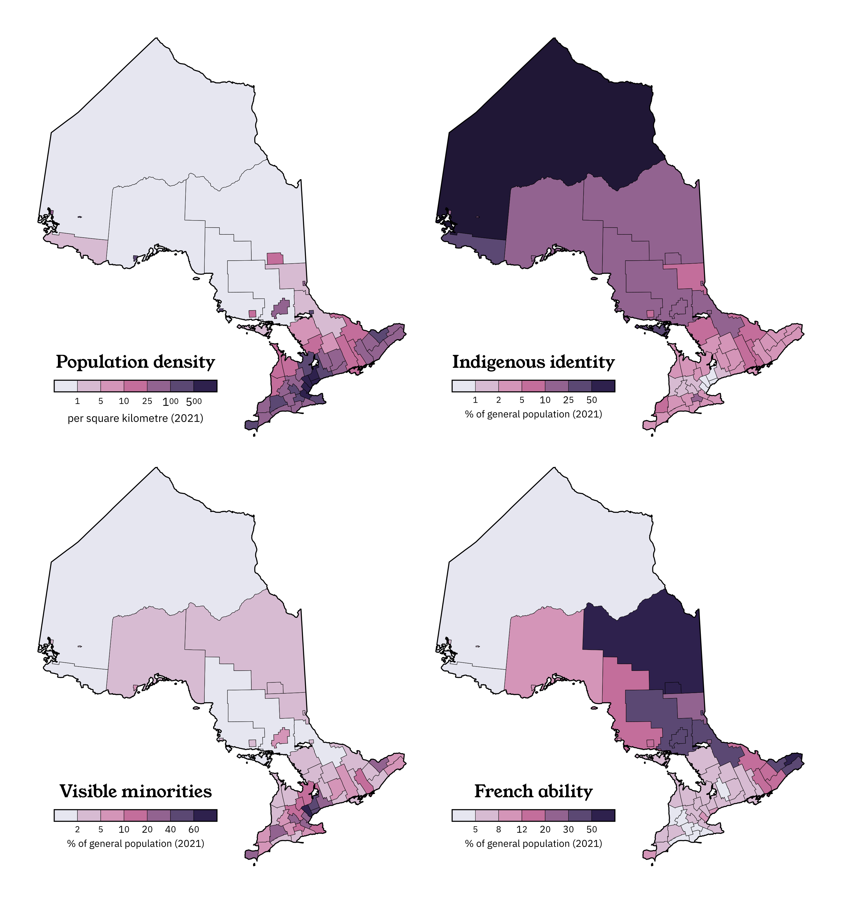
Demographics of Ontario

Population of Canada
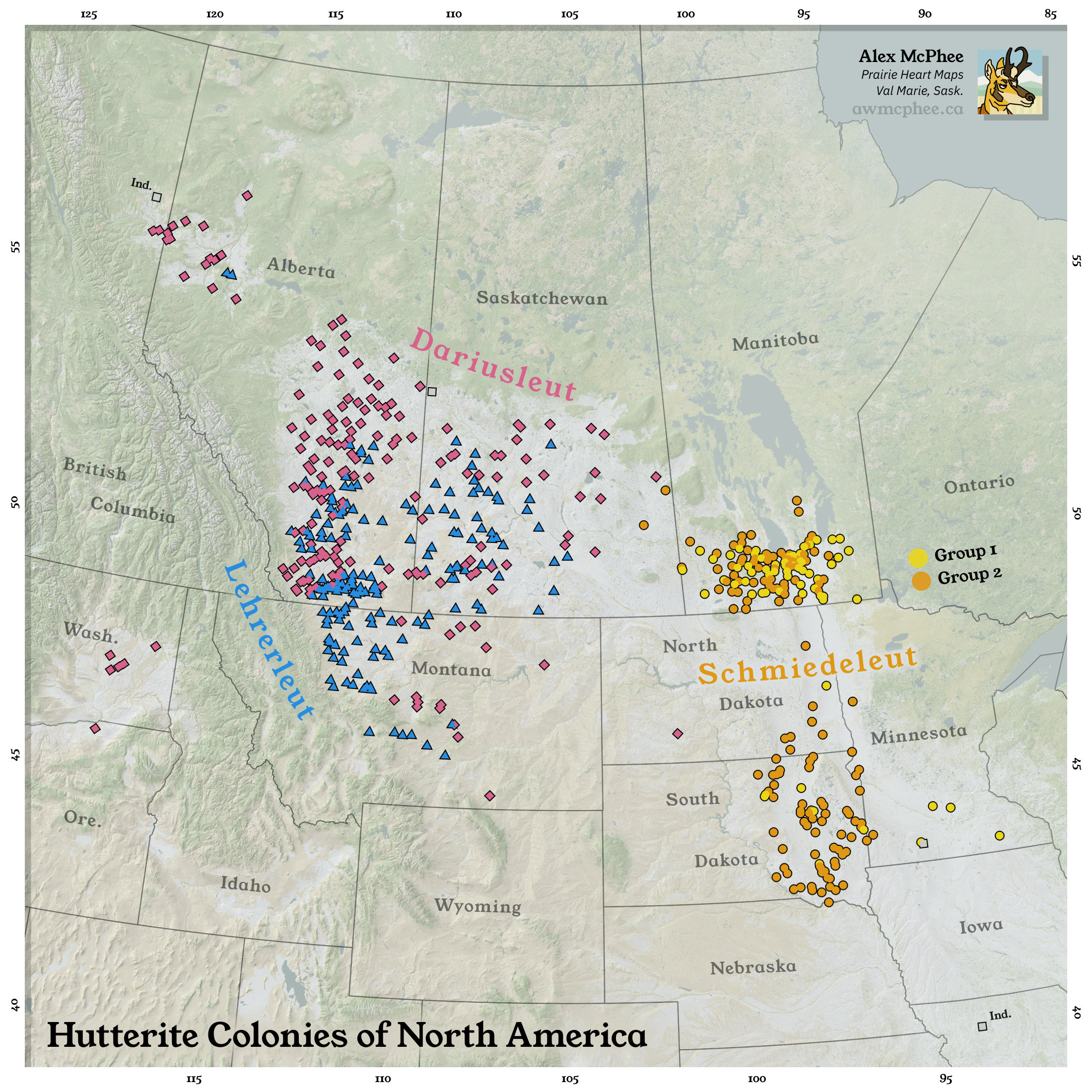
Hutterite Colonies of North America

The Nearest National Park
India general election, 2019
Canadian politics: 2015 vs. 2019
Religion in the Dominion of Newfoundland
Community-Issued Travel Restrictions
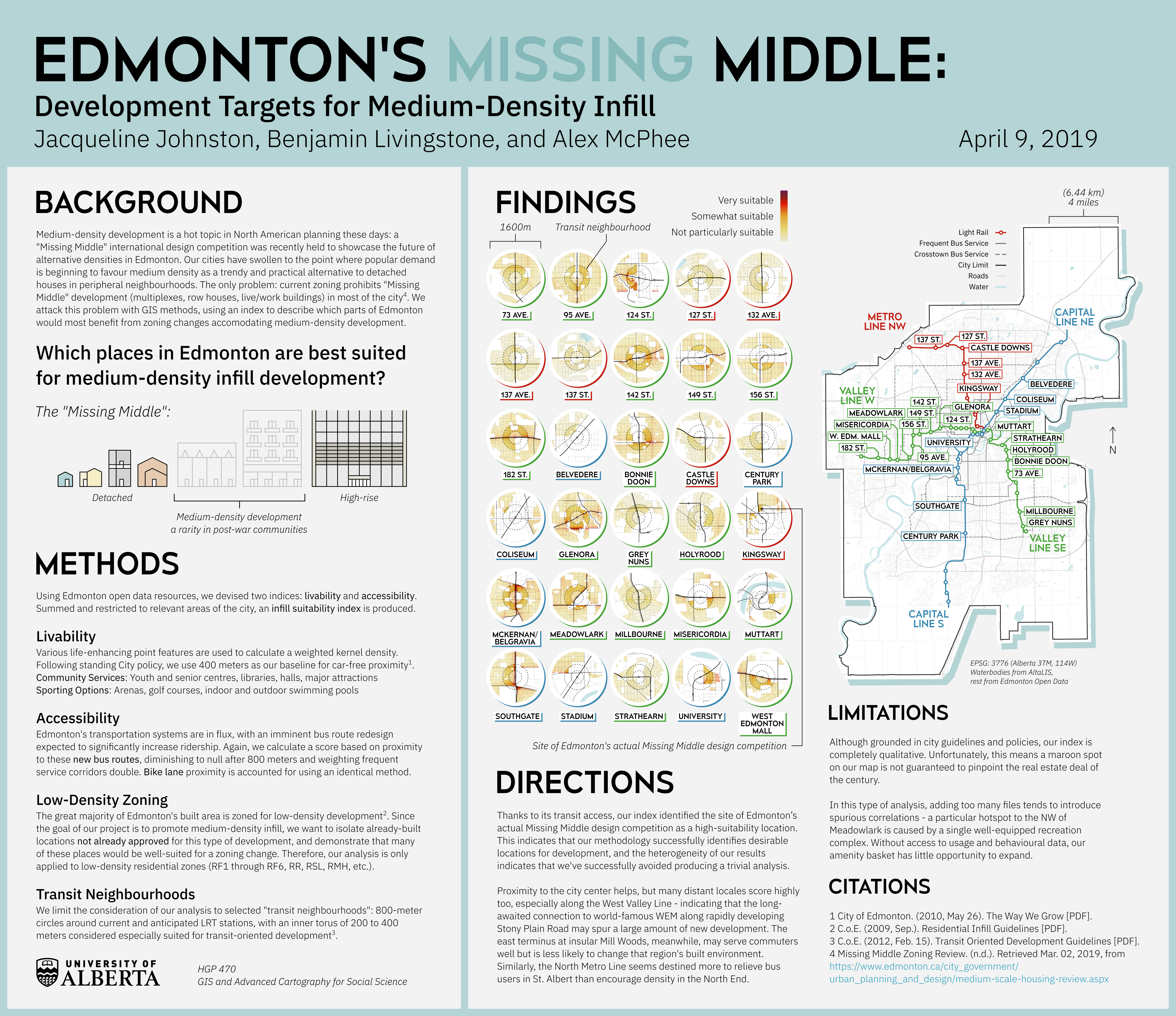
Edmonton's Missing Middle

Most Common Ethnicities of Canada
For Paying Clients
I can work to your brand guidelines and provide unique data insights: let's talk!
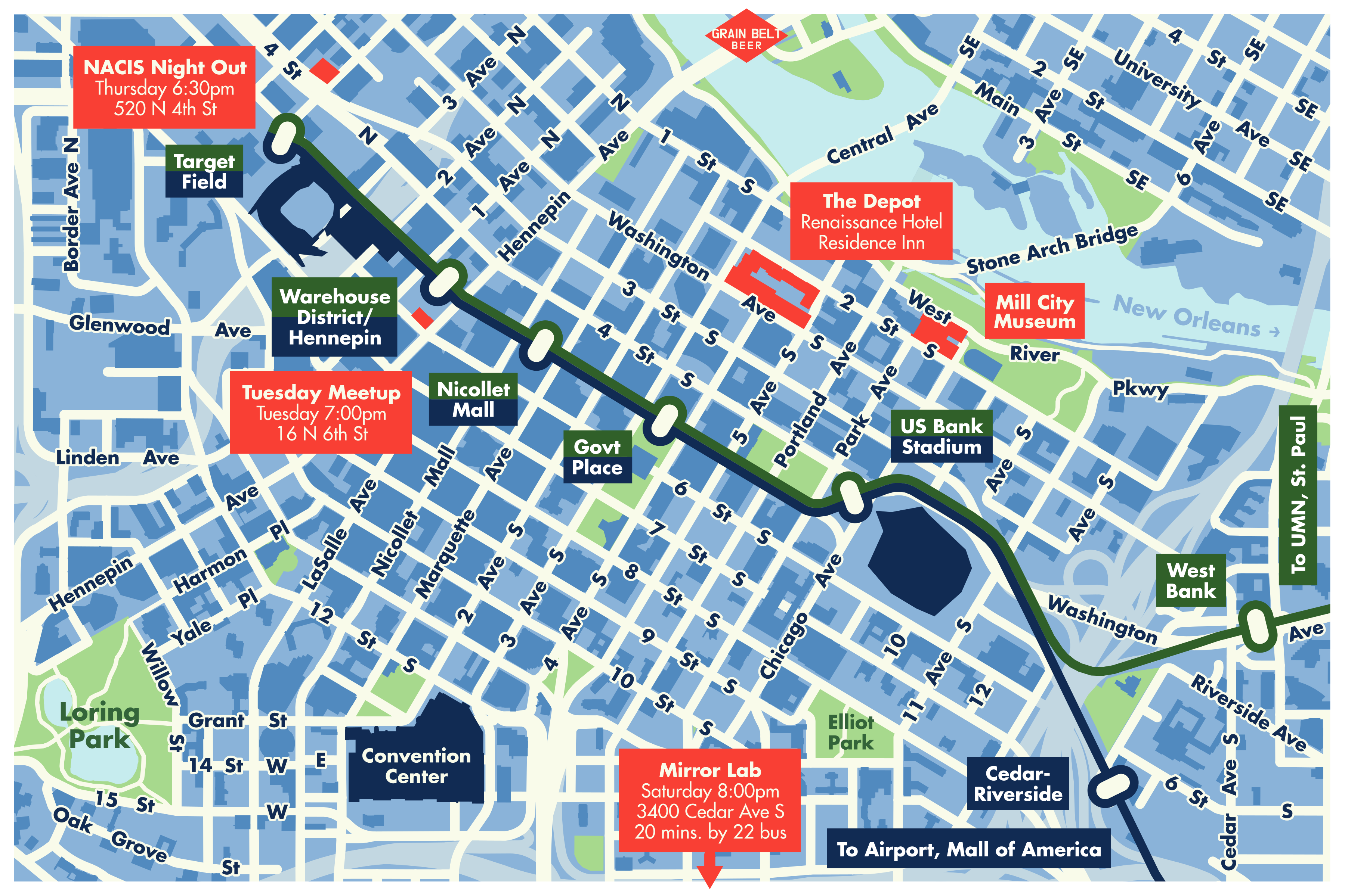
Minneapolis Program Map
North American Cartographic Information Society
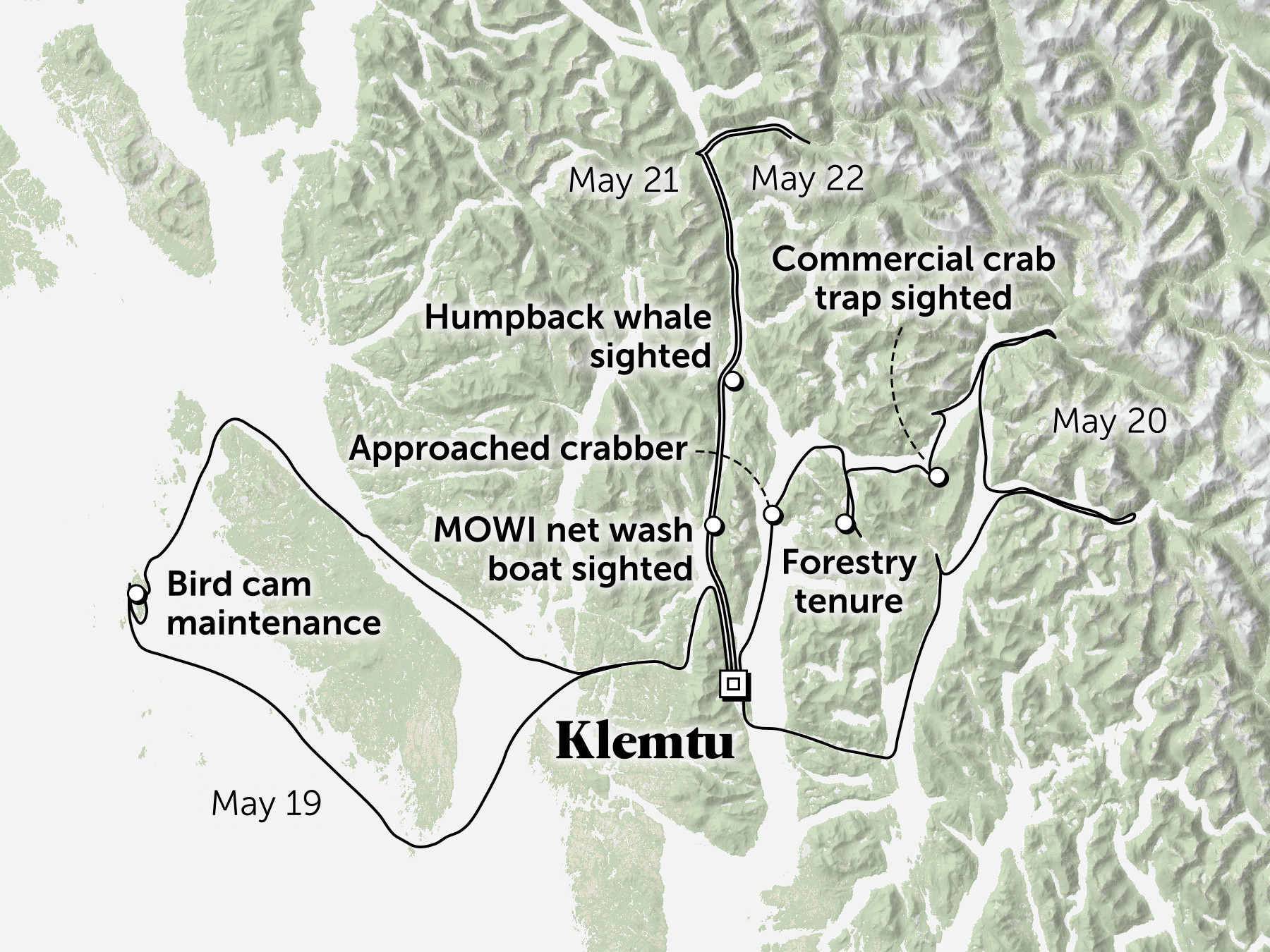
Klemtu Territory Patrol
The Narwhal
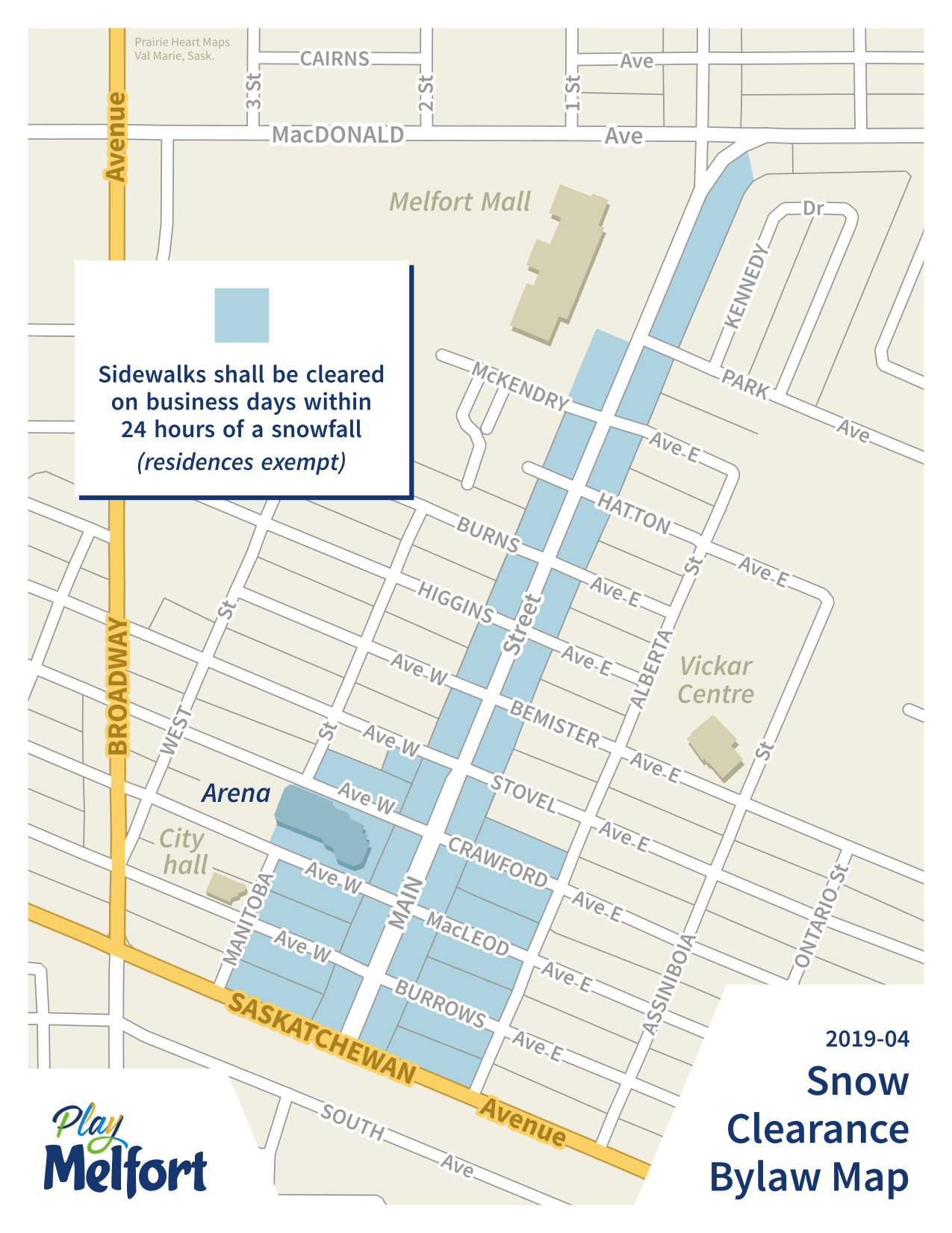
Snow Clearance Bylaw Map
City of Melfort, Saskatchewan
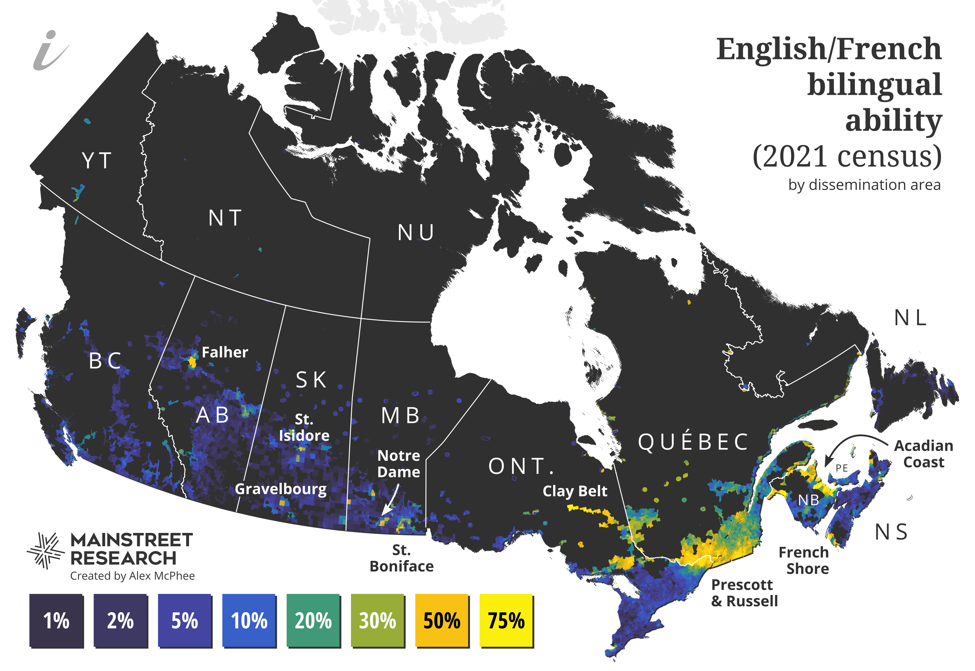
English/French bilingual ability
Mainstreet / iPolitics
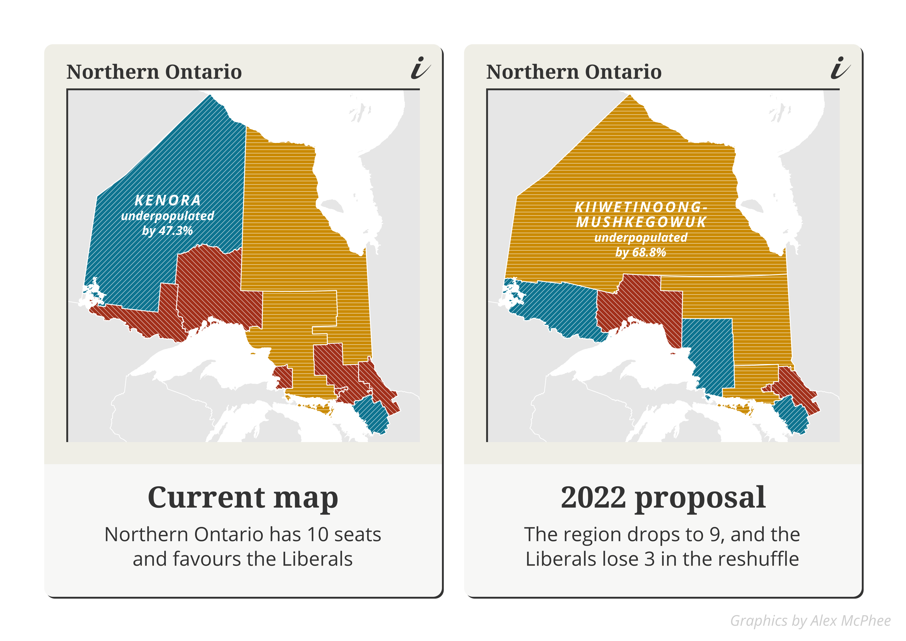
Boundaries in Northern Ontario
Mainstreet / iPolitics
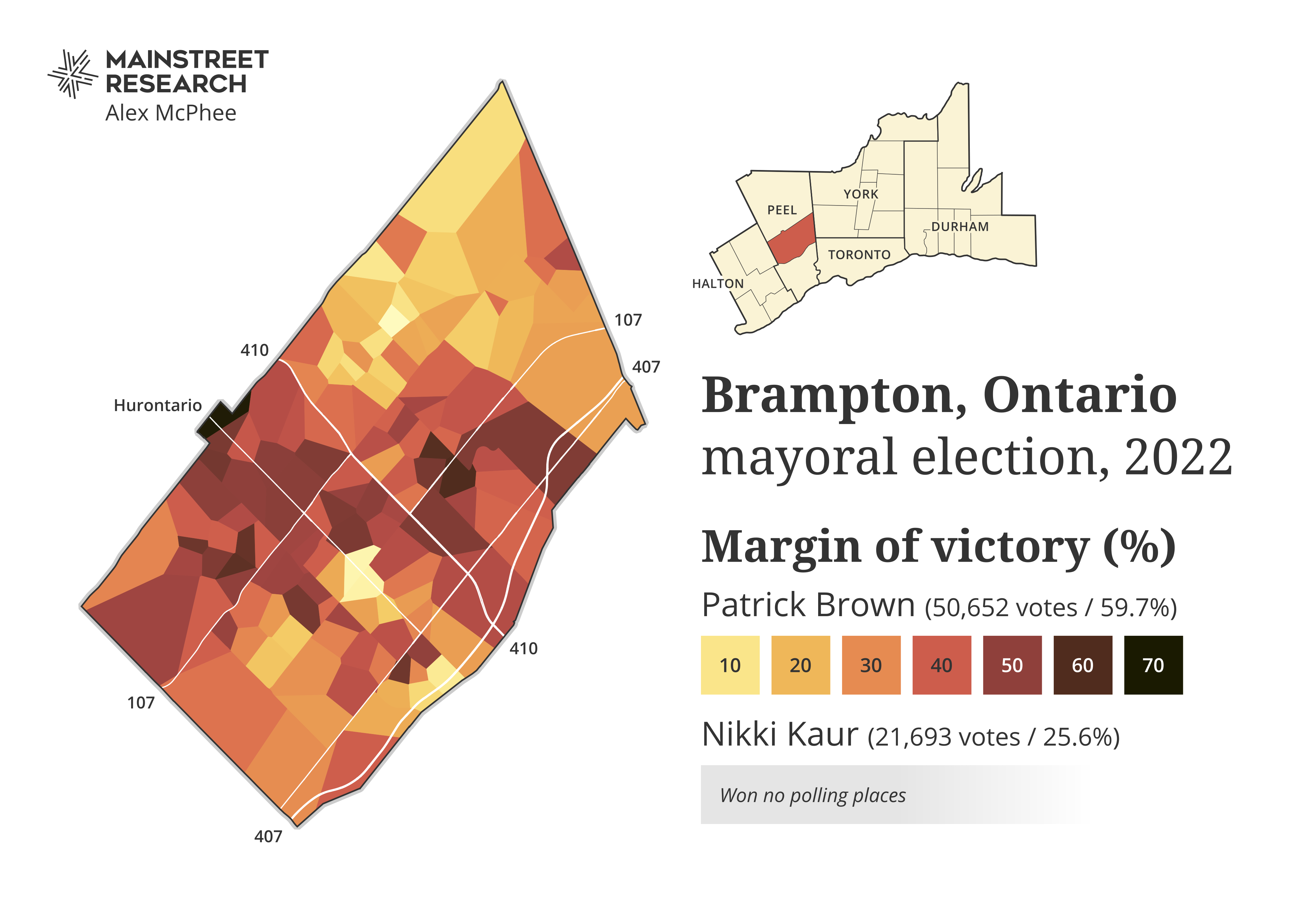
Brampton mayoral election
Mainstreet / iPolitics
Games
Because visiting websites should be fun again!


Alex's Census Game
How many communities can you name? Freshly updated with 2021 population data. Be warned: this game is both addictive and difficult.
Play →Fictional Maps
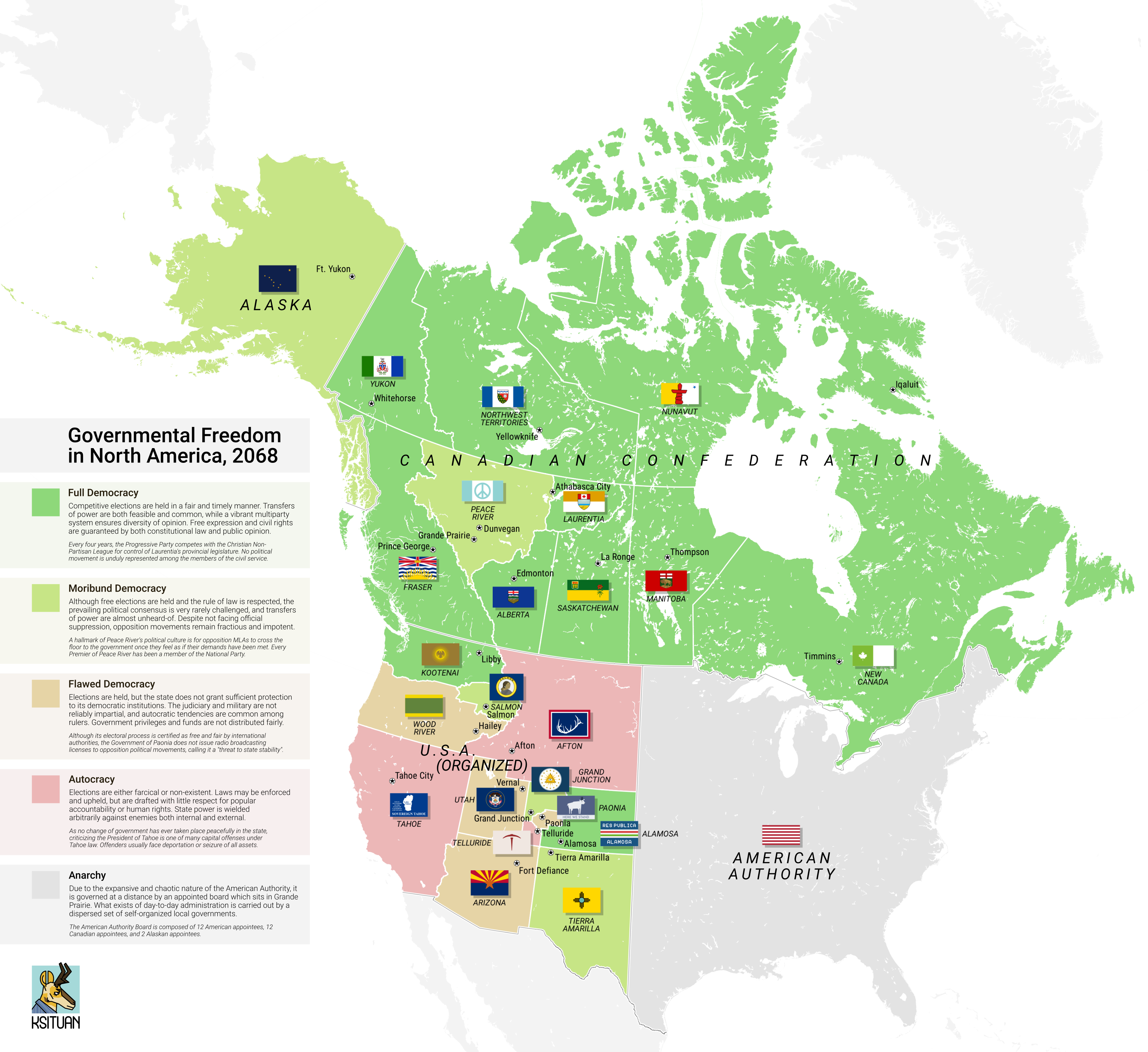
Governmental Freedom in North America, 2068
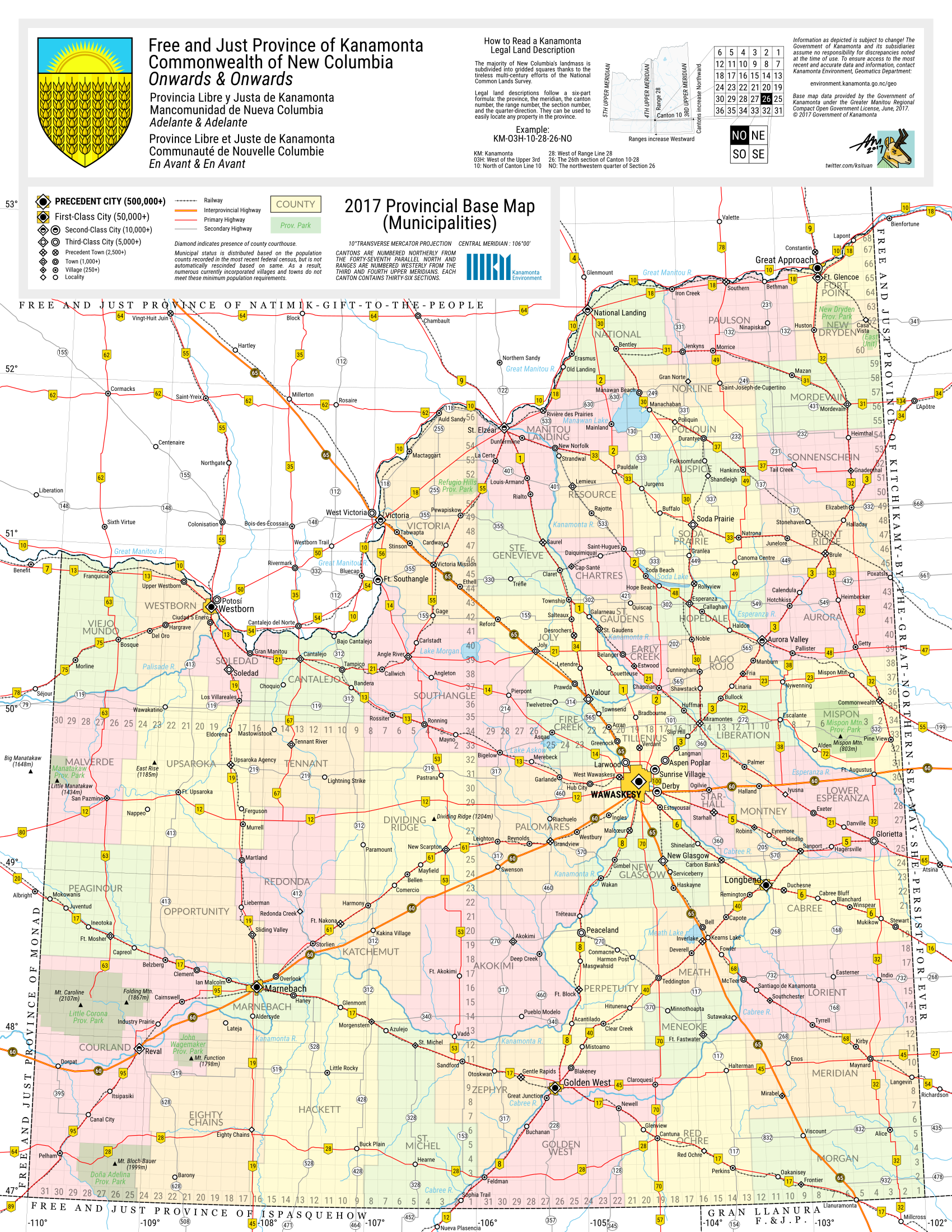
Kanamonta Province
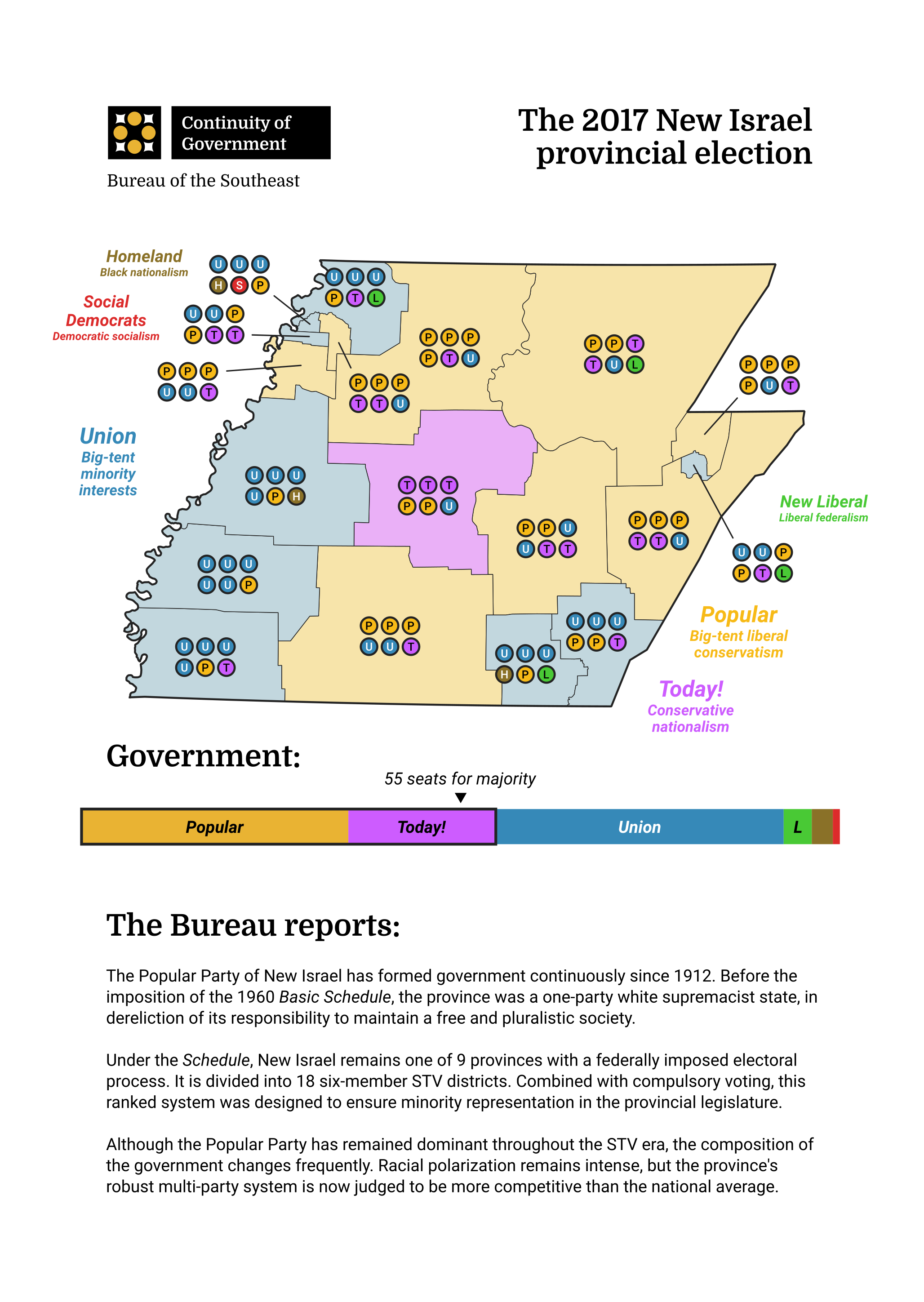
New Israel provincial election, 2017
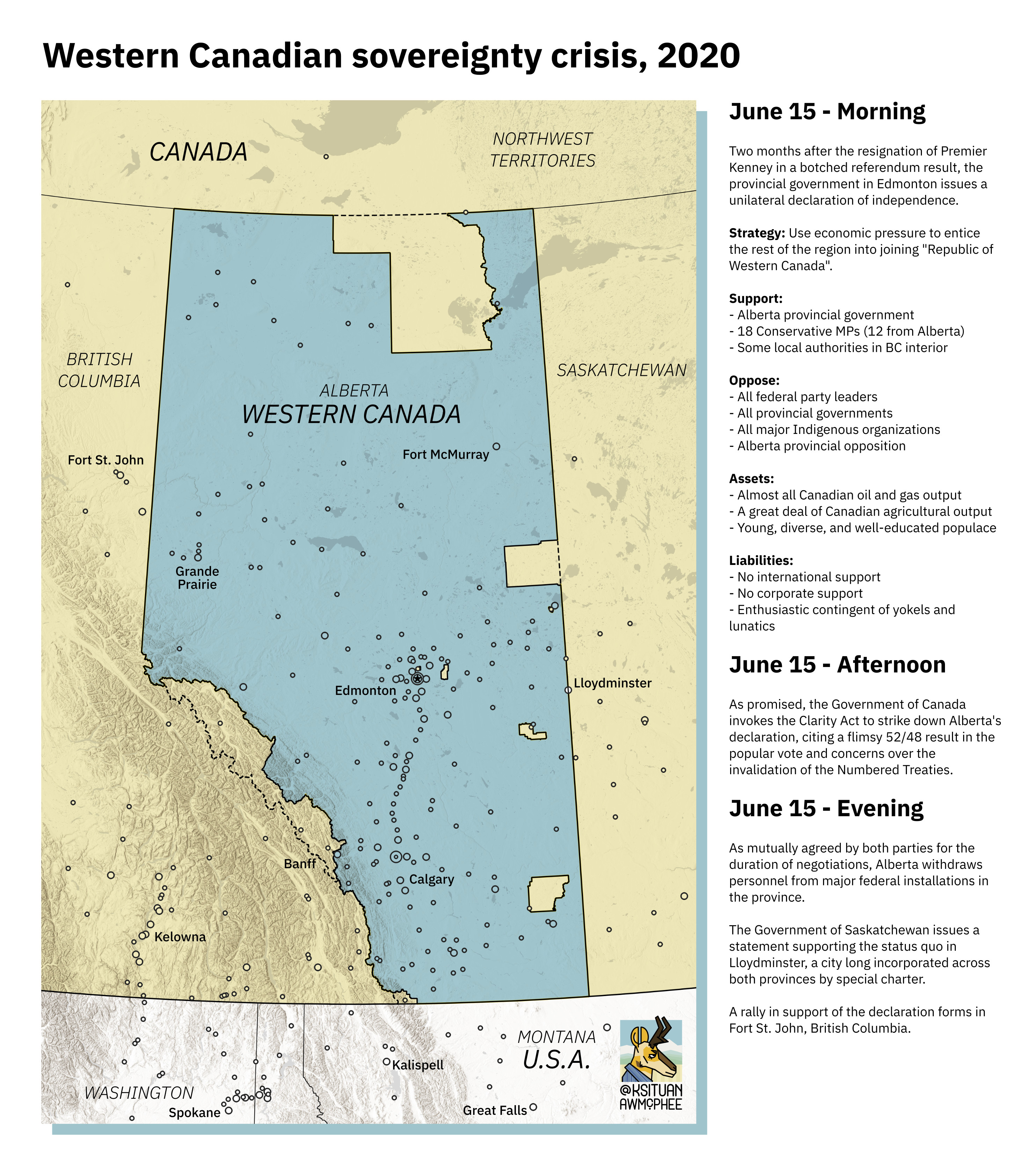
Western Canadian sovereignty crisis, 2020
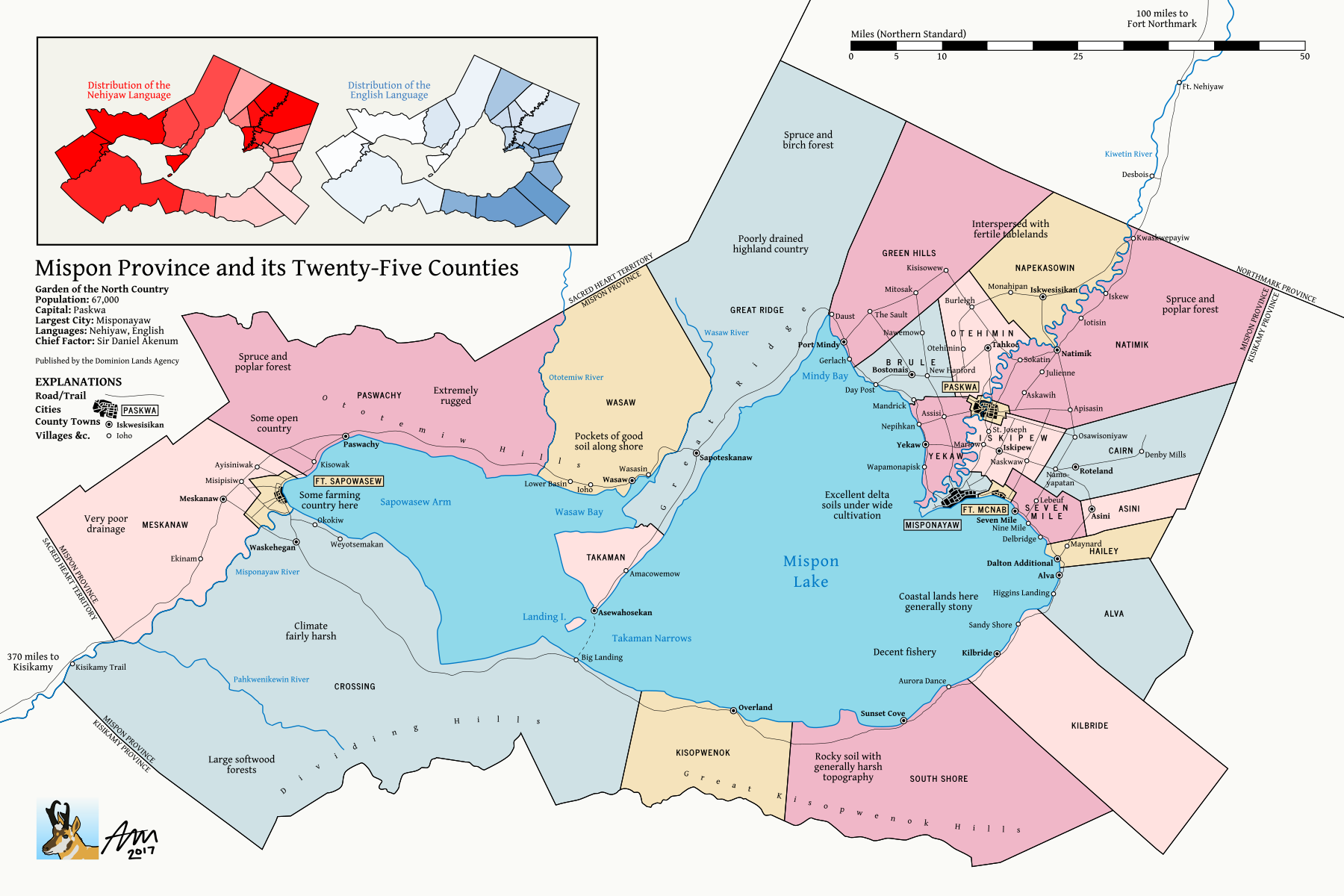
Mispon Province
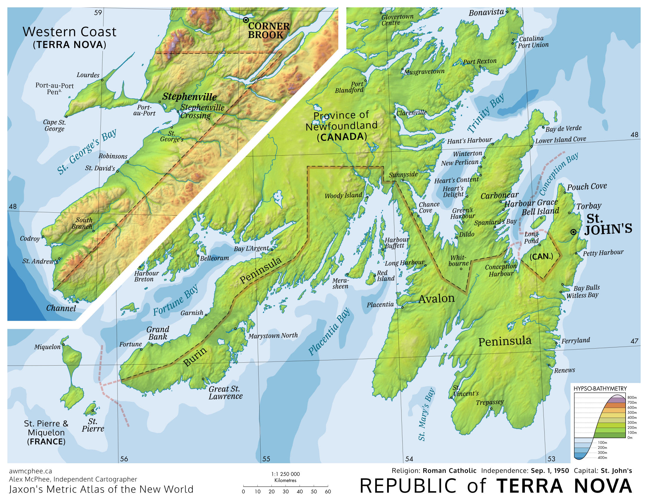
Republic of Terra Nova
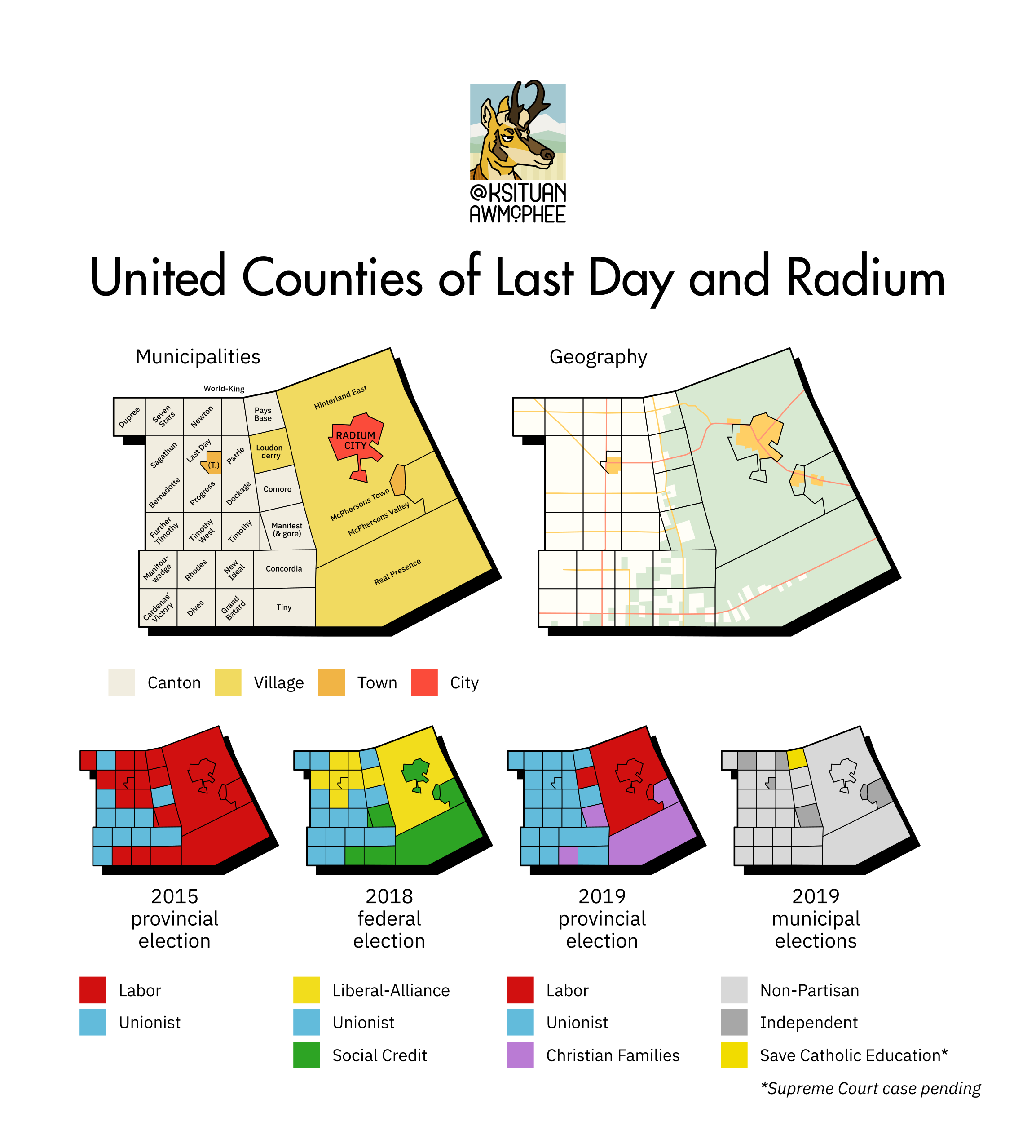
United Counties of Last Day and Radium
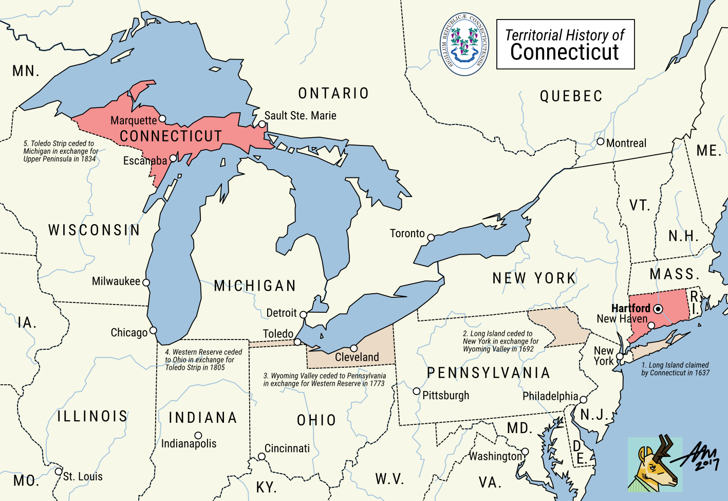
Territorial History of Connecticut
30 Day Map Challenge


Every November...
Is it really possible to design 30 maps in 30 days? See for yourself.
My 30DMC gallery →Appendix
Interested in starting your own map business? Here's all of my advice on how to work with a commercial press.