
Alex McPhee
Pronghorn Maps
30 Day Map Challenge
It's on!
Every November, the cartographic community braces itself for the grueling 30 Day Map Challenge.
As a freelancer, I really enjoy the opportunity to test my skills. These are my daily submissions from past years.
2021
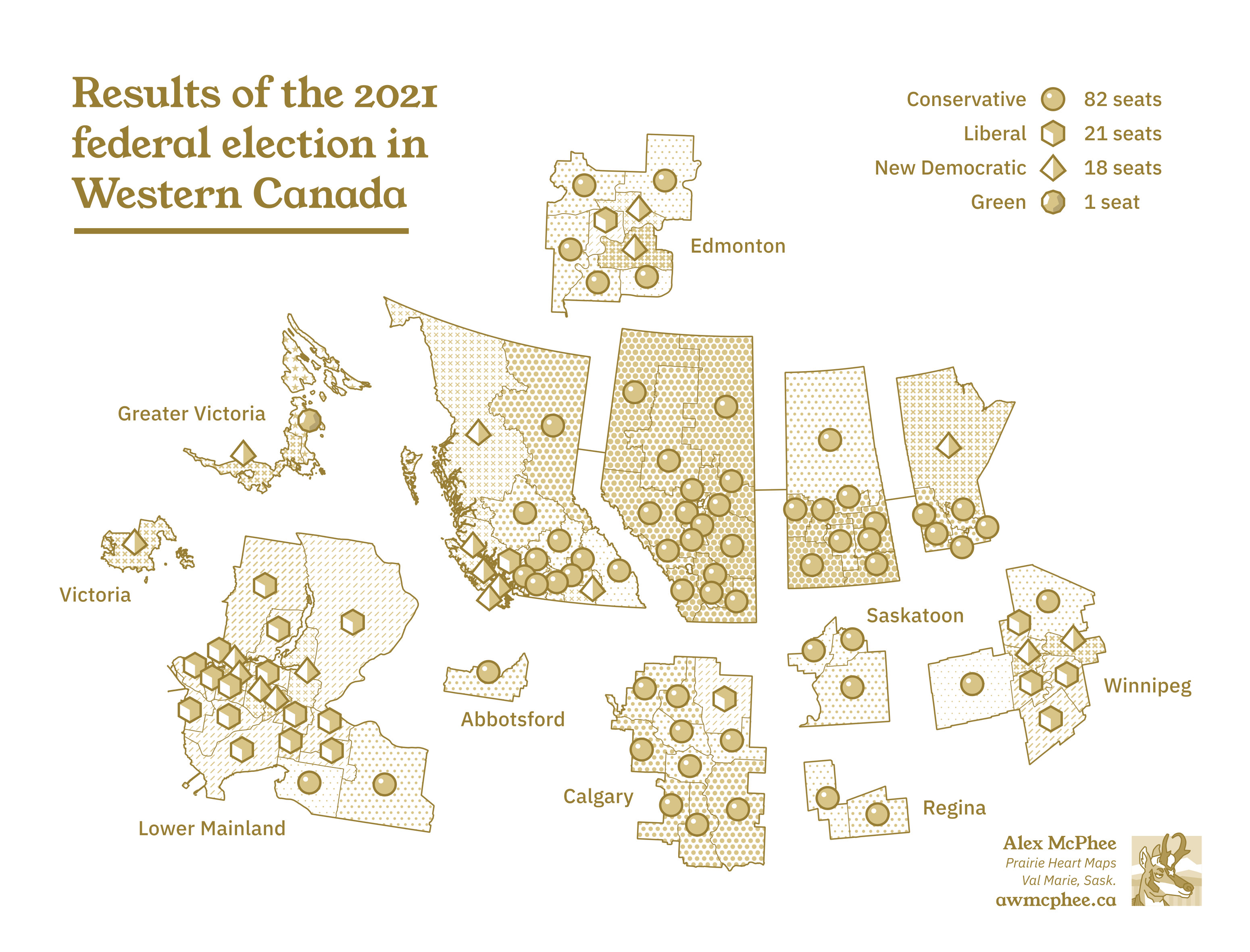
1. Points

2. Lines

3. Polygons

4. Hexagons
5. OpenStreetMap

6. Red
7. Green

8. Blue
9. Monochrome
10. Raster
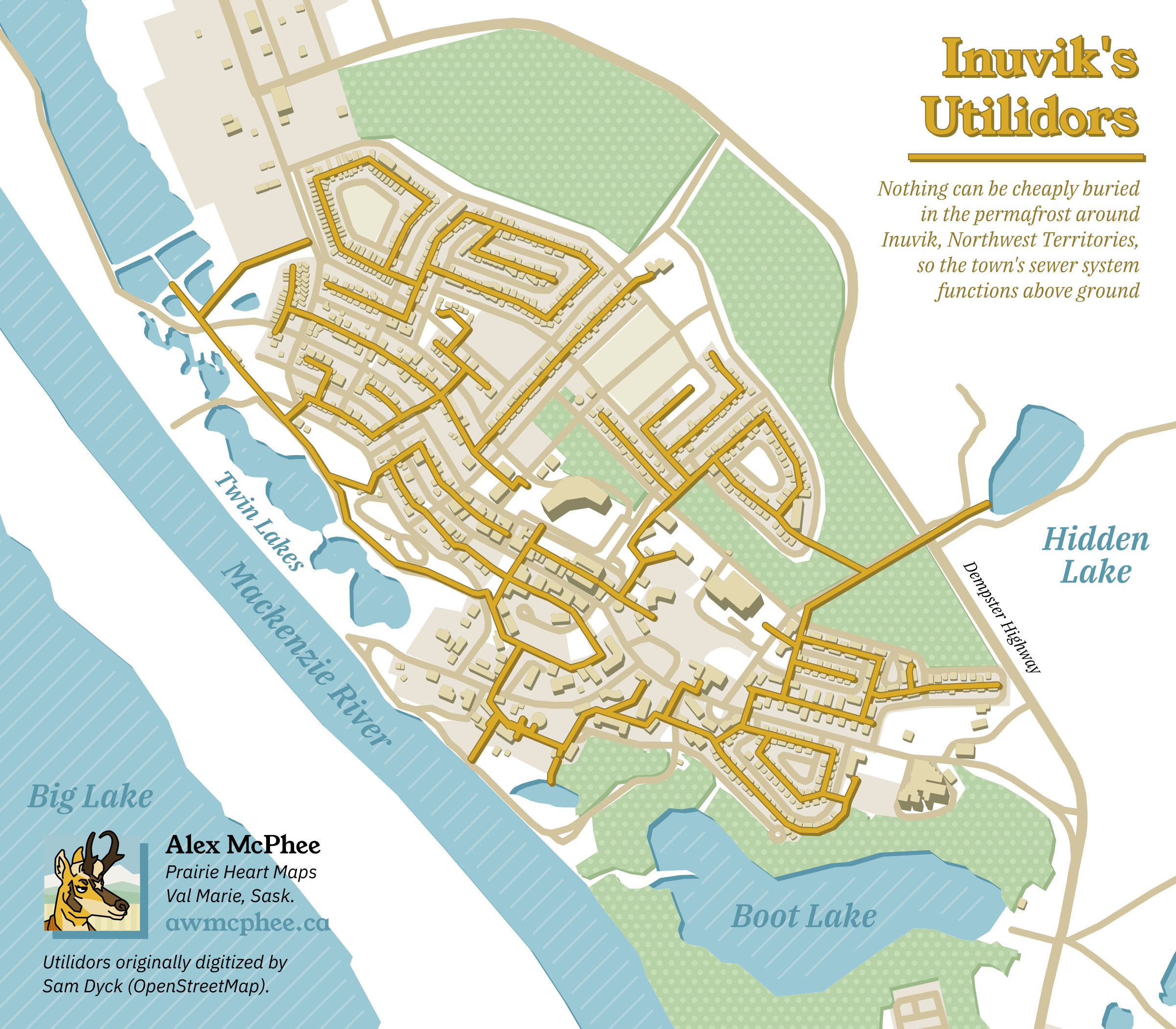
11. 3D
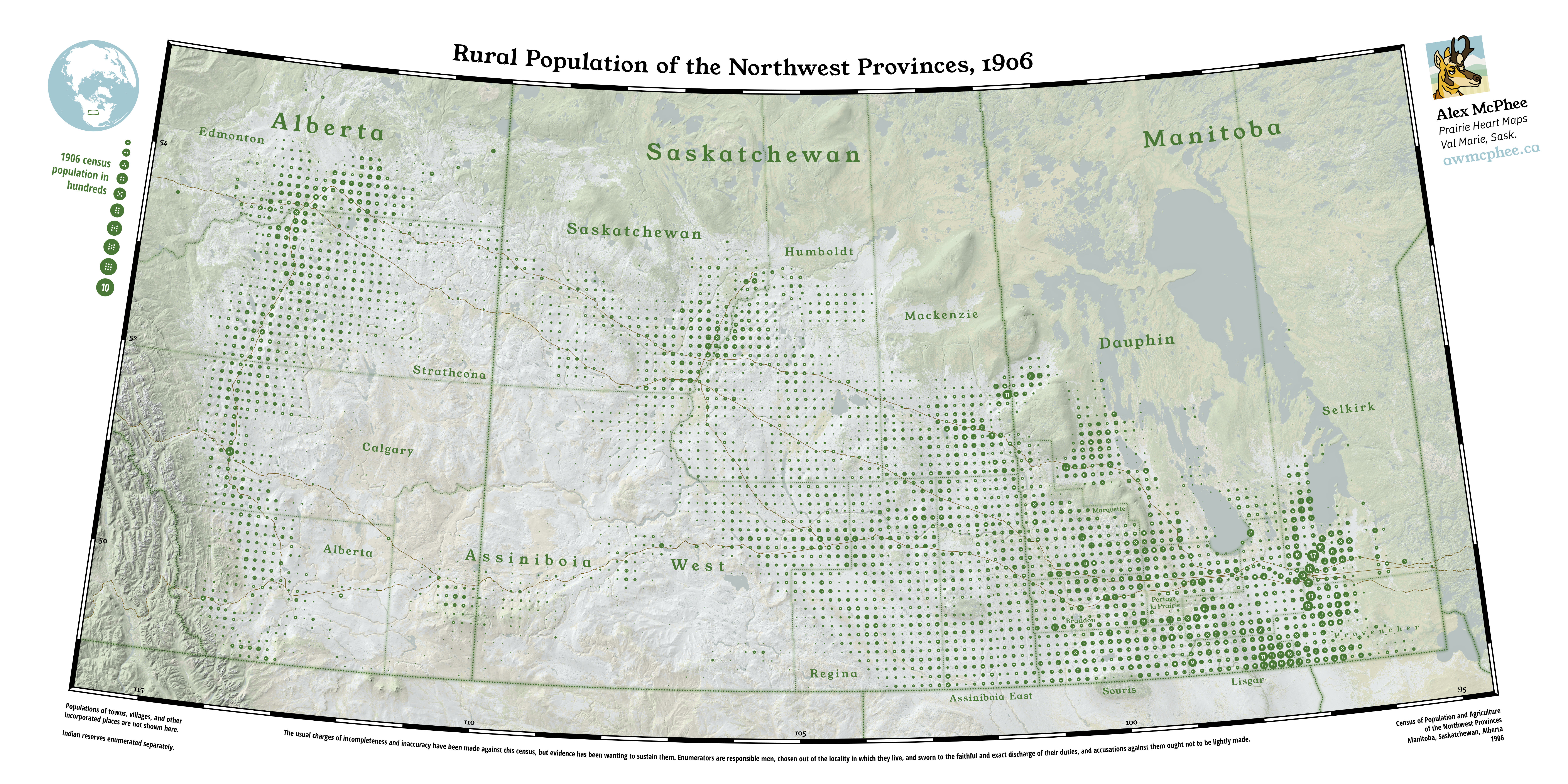
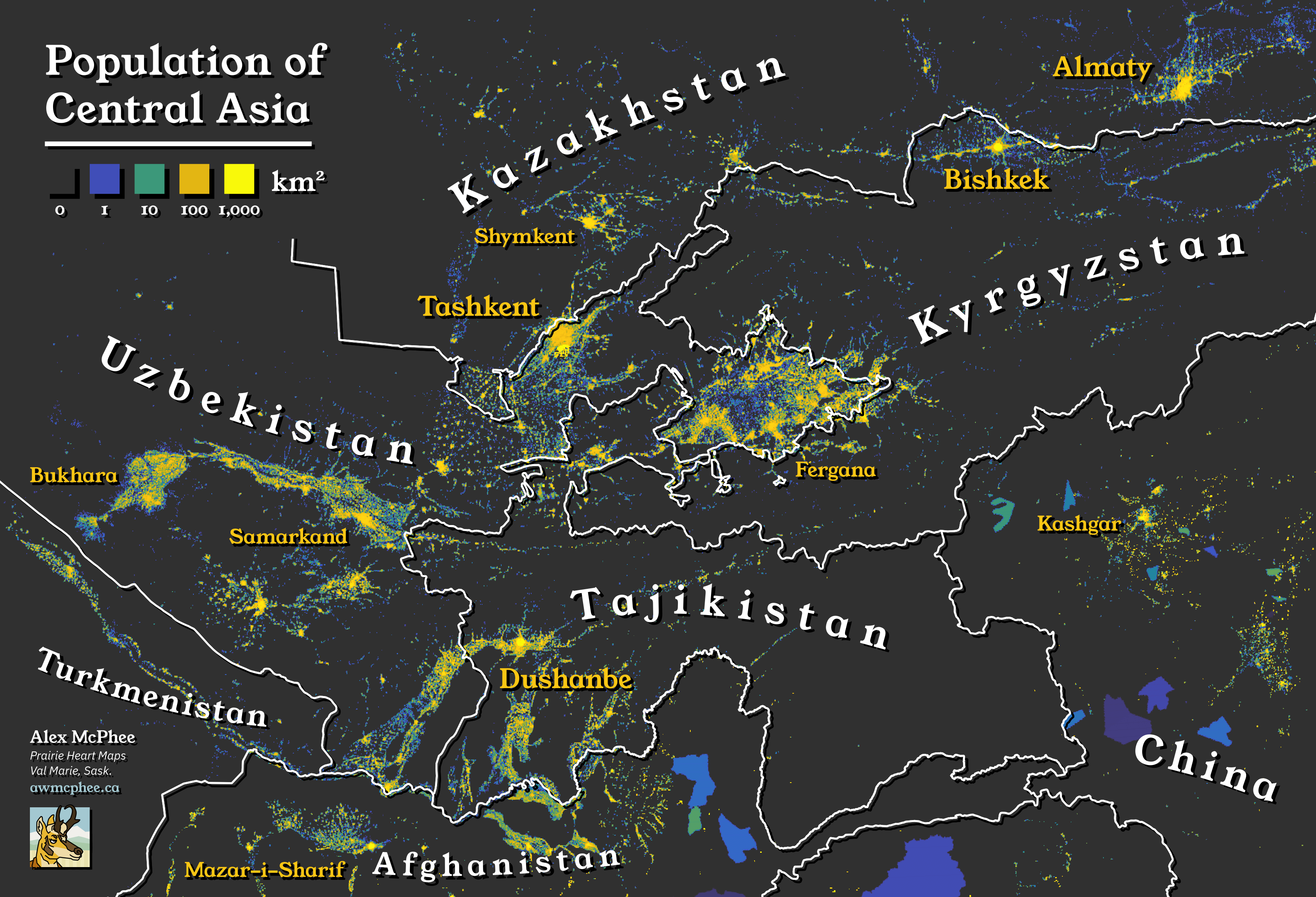
12. Population
13. Natural Earth


14. Map with a new tool
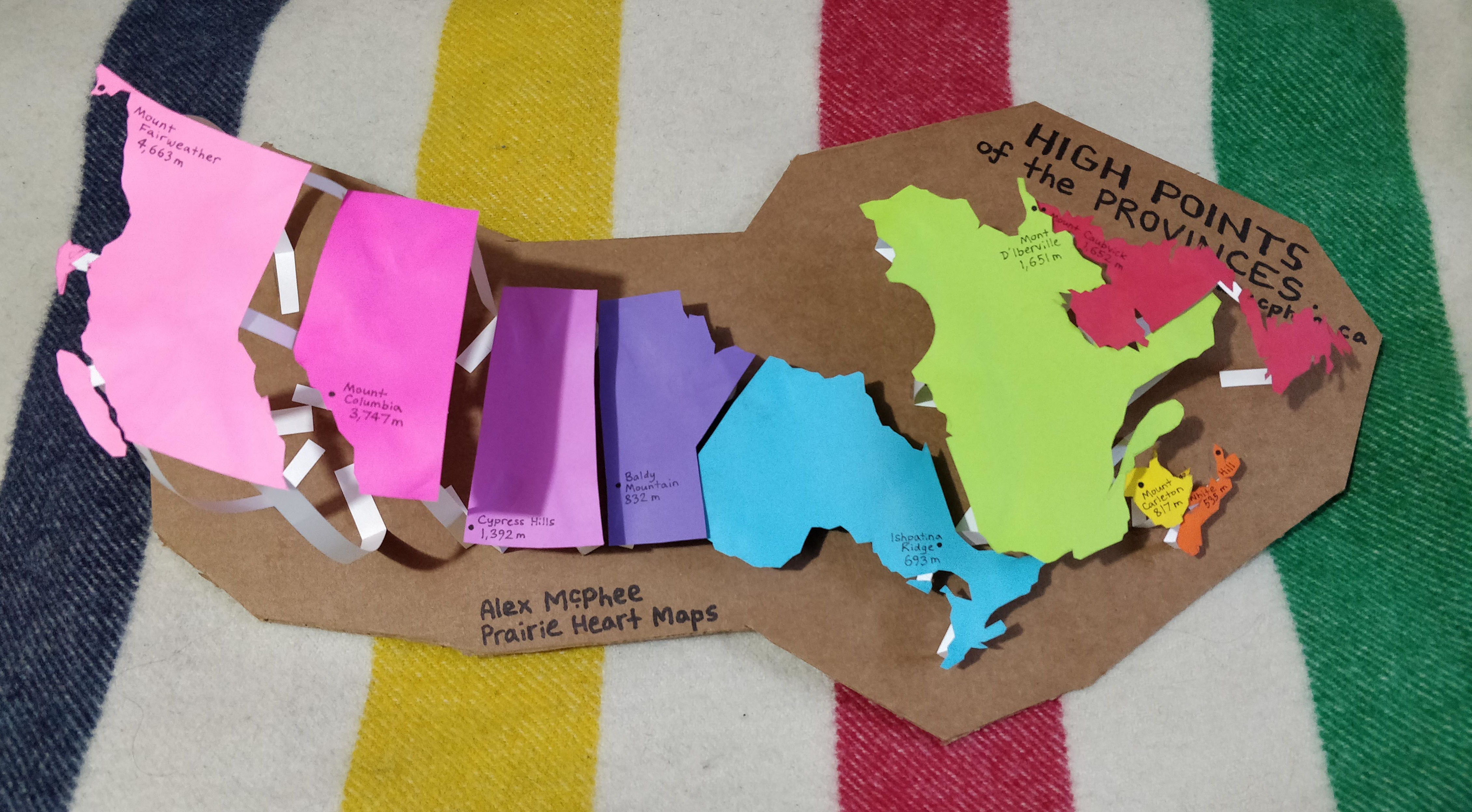
15. Map made without using a computer
16. Urban/rural
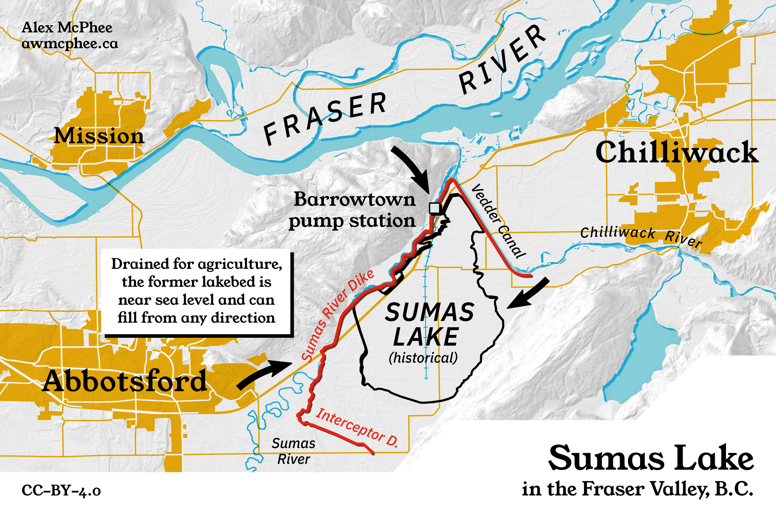
17. Land
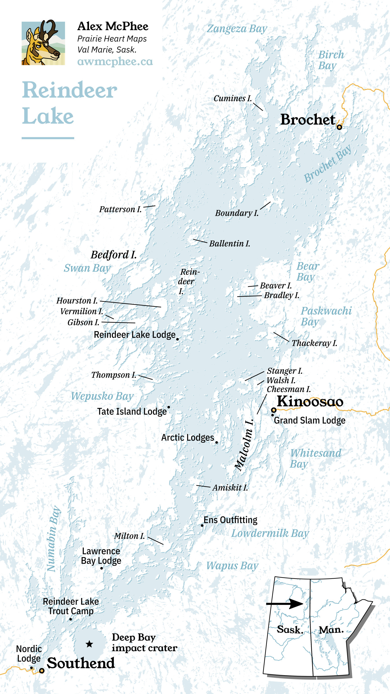
18. Water
19. Island(s)

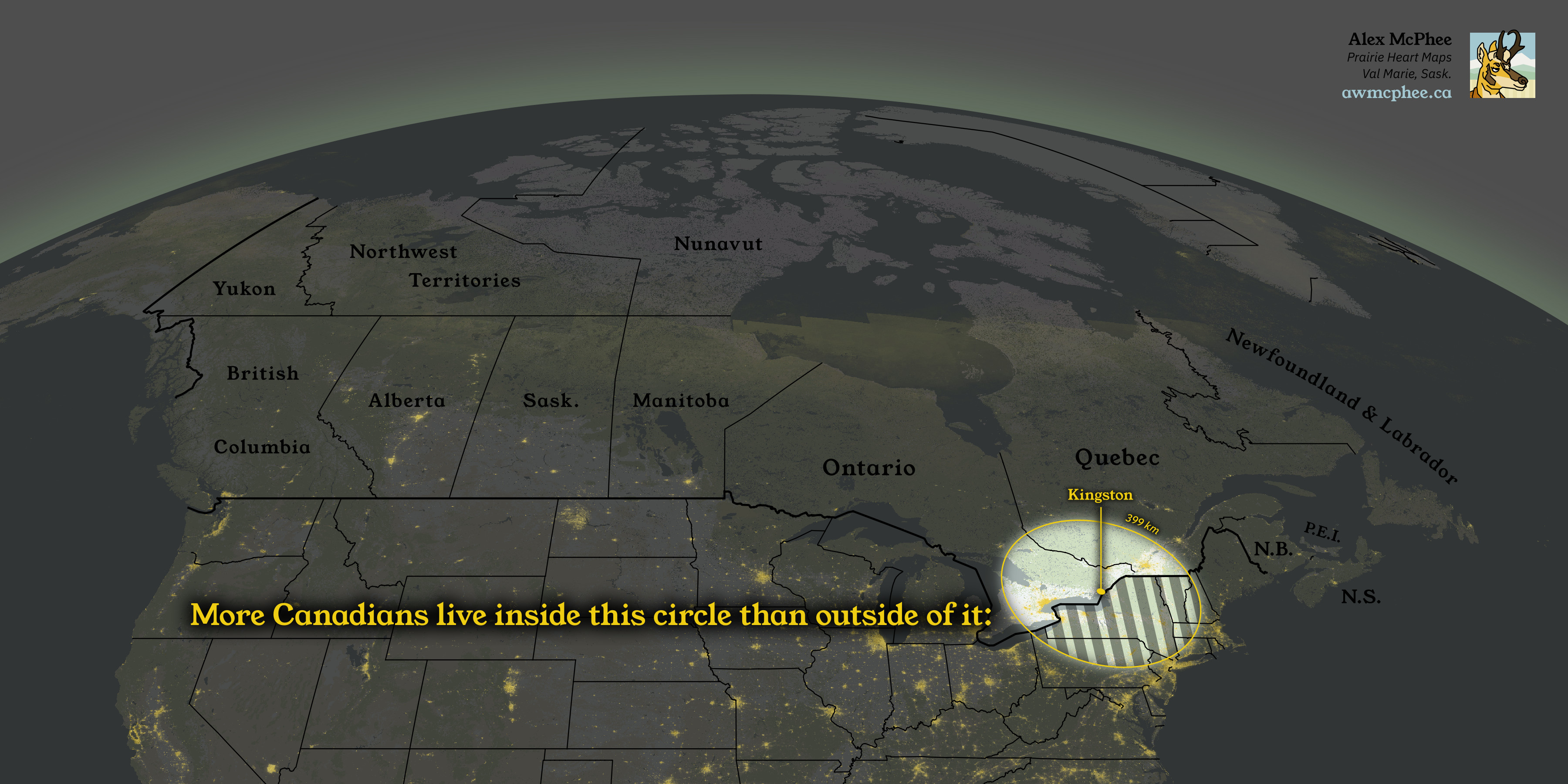
20. Movement
21. Elevation
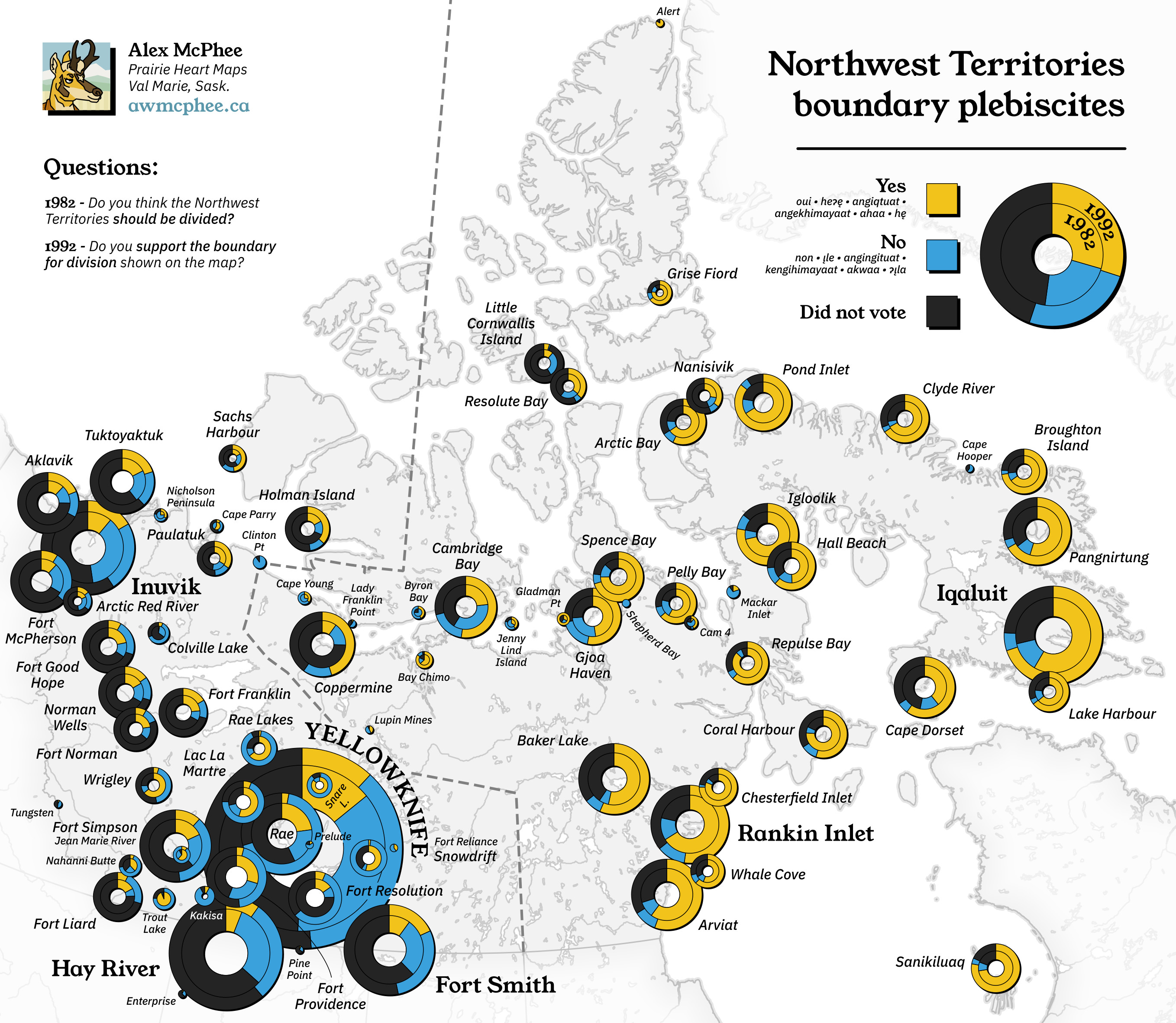
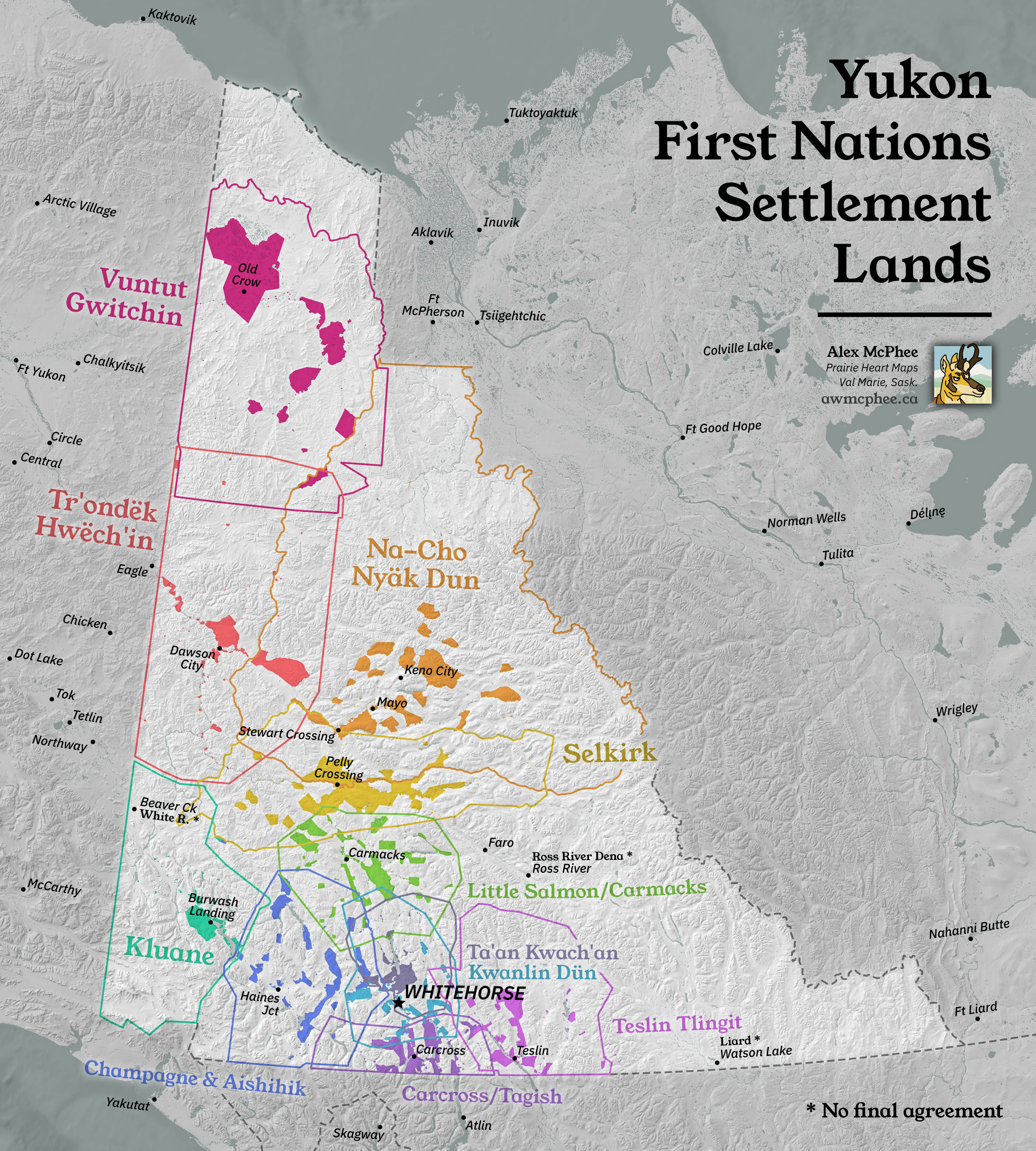
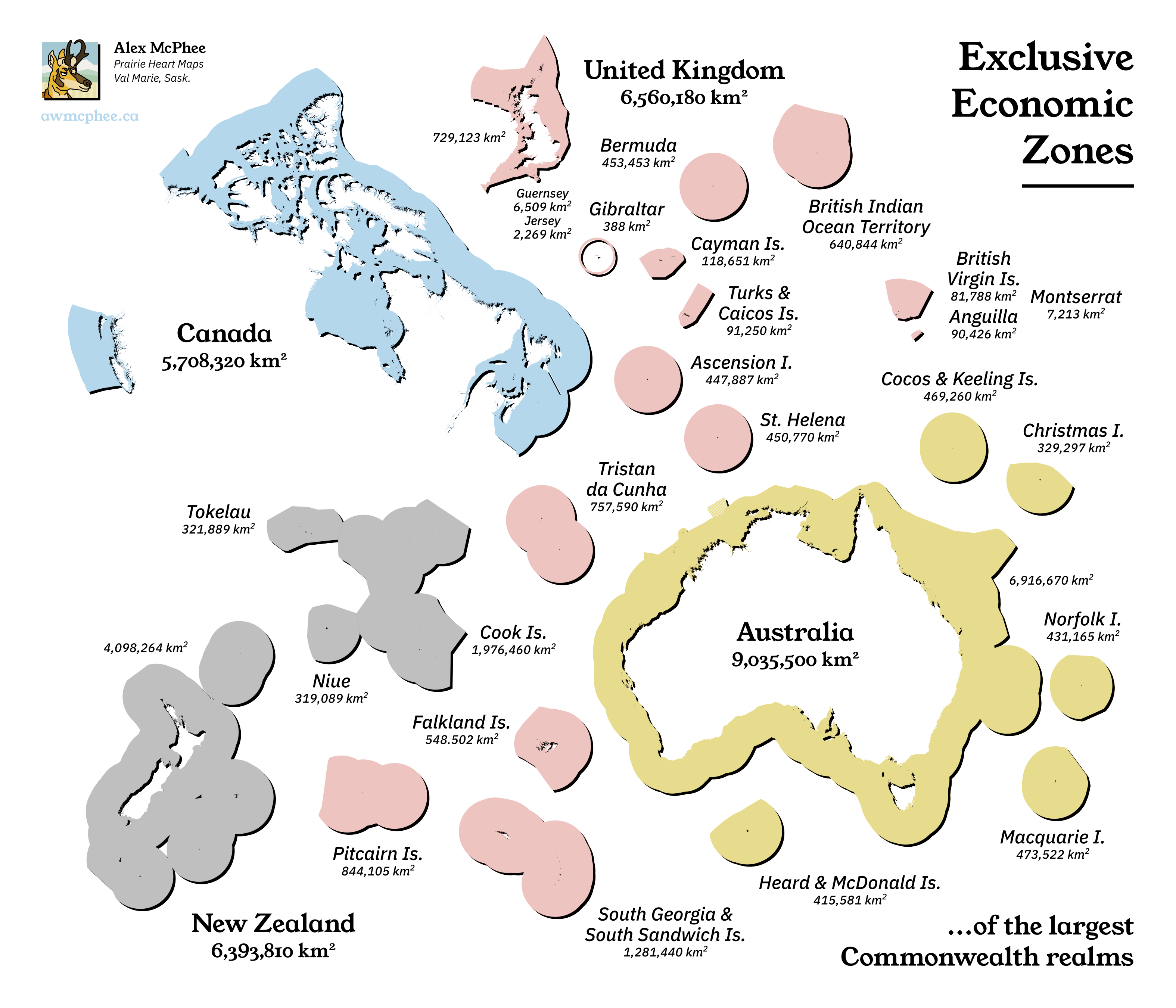
22. Boundaries
23. GHSL
24. Historical map


25. Interactive map
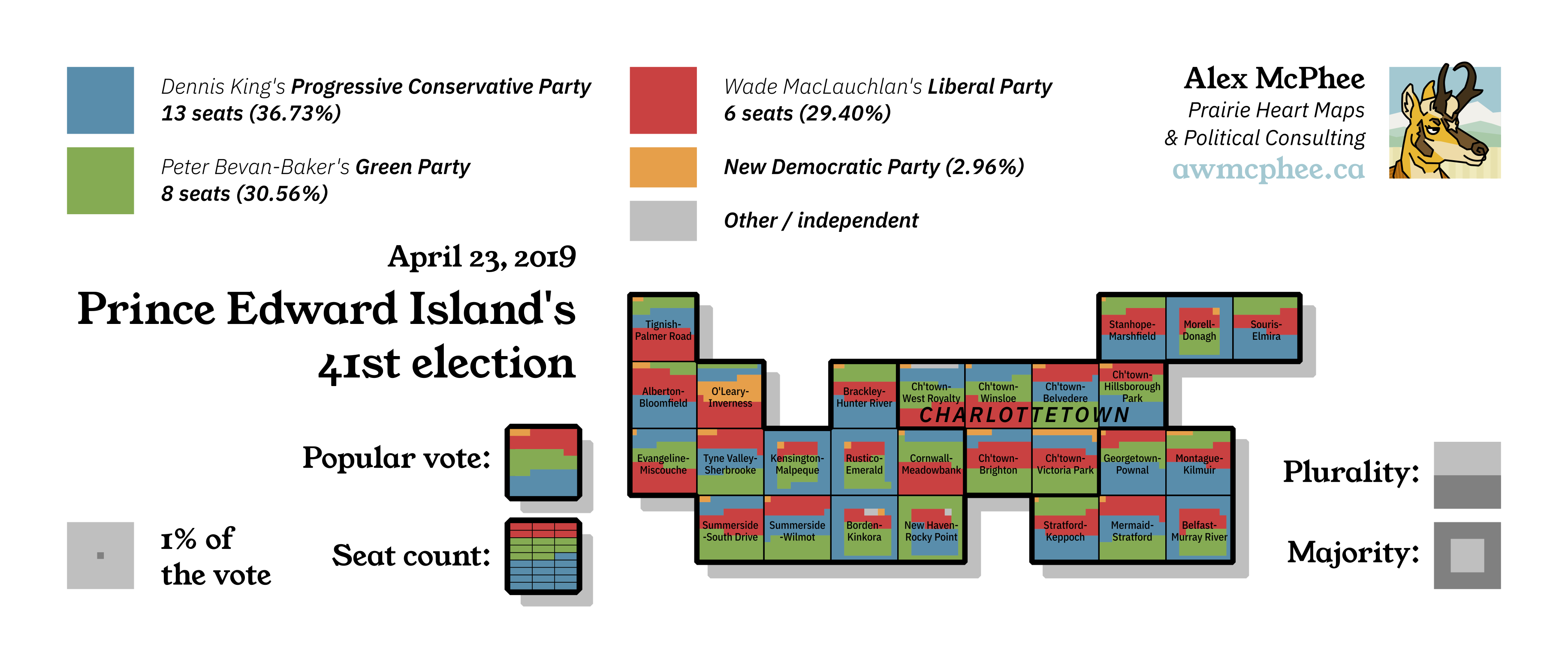
26. Choropleth map

27. Heatmap

28. The Earth is not flat
29. Null
30. Metamapping day
2020
All of these images can be right-clicked and opened in a new tab.


1. Points


2. Lines


3. Polygons


4. Hexagons


5. Blue


6. Red


7. Green


8. Yellow


9. Monochrome


10. Grid


11. 3D


12. Map not made with GIS software


13. Raster


14. Climate change


15. Connections


16. Island(s)


17. Historical map


18. Landuse


19. NULL


20. Population


21. Water


22. Movement


23. Boundaries


24. Elevation


25. COVID-19


26. Map with a new tool


27. Big or small data


28. Non-geographic map


29. Globe

